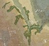
Correct, we may say NW/NWW better. We preferred to orient the map in the direction (left/right) of the most important flows, to include the more terrain was possible for the action. The PLS map, that however represents a whole different game scale, is not accurate in relation of the heights, Borbalamajor and Alsopuszta are the topmost, the woods SW of Zamoly are on lower levels. The woods in the draft posted by Honza are not the definitive, these below are closer to the definitive. The shape of the woods in PLS are as they are now, we drew the shape as in 1945Panzers Last Stand has a scenario on the battle of Zamoly.
It appears the HASL map posted is oriented with West on top. Looks like the few hexes around the Zamoly town, with the bend in the Forras river and with hills to the south.
View attachment 27691
View attachment 27692

Last edited:

 -- jim